I've worked with Ordnance Survey and EDINA for many years.
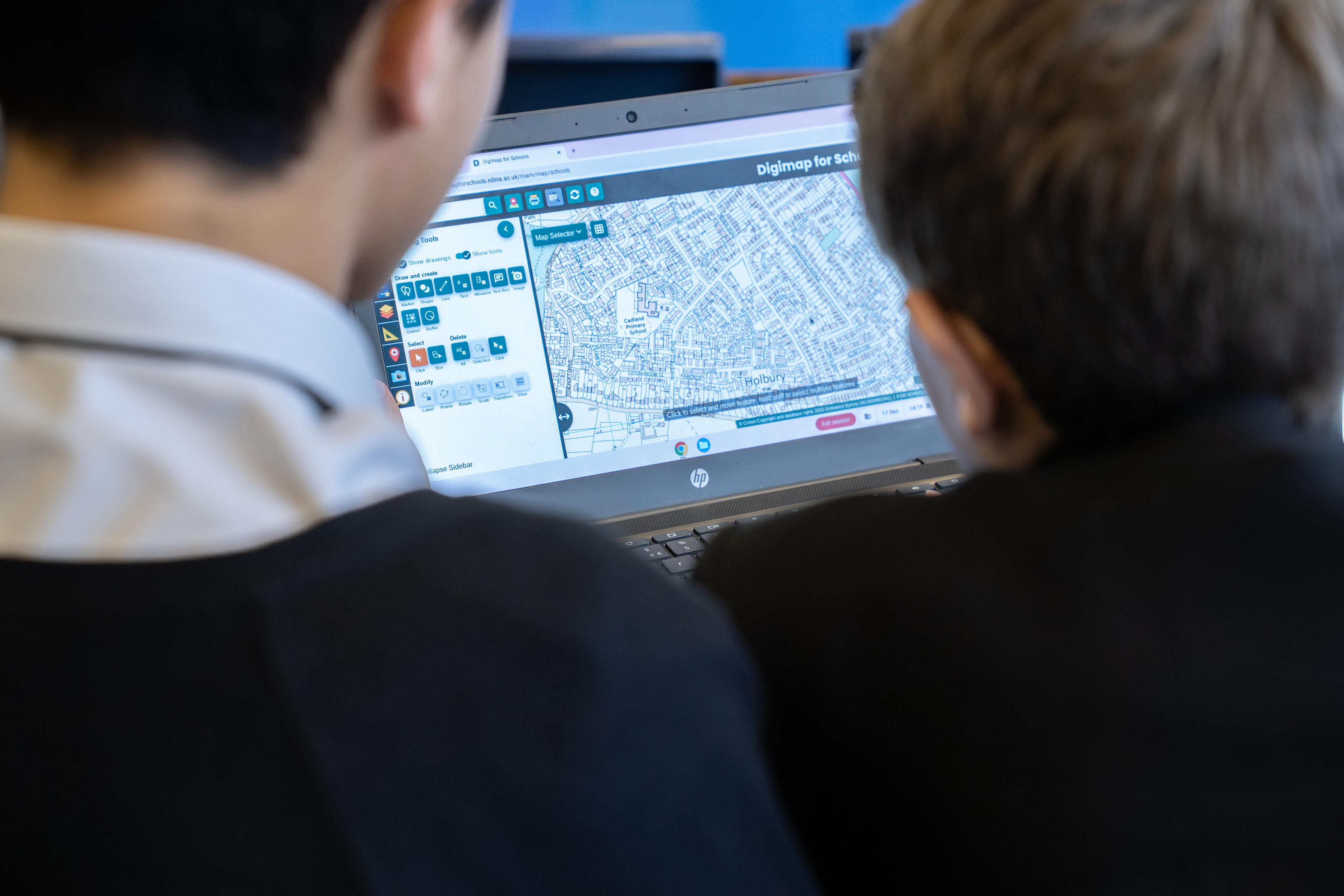
Digimap for Schools is aligned with the national curricula across Great Britain and enables students aged five to 16 and above to understand and investigate their world while gaining crucial digital and data skills. It is supported by access to a huge library of free learning resources, also available in Welsh, that are designed to aid teaching and support teachers in preparing impactful and interesting lessons, as well as allowing for student-led self-study.
OS recently published an impact report on its commitment to lifelong learning in geography and geospatial. It also collaborates closely with organisations such as the Royal Geographical Society and the Geographical Association on a wide range of activities including the teaching of geography in schools, educational outcomes, and promoting geography.
Headteachers of eligible schools will be directly contacted about the new offer in the next month. For further information about the Digimap for Schools free access scheme visit: https://digimapforschools.edina.ac.uk/about/imd/.
Ordnance Survey (OS) will reach out to 1,800 primary and secondary schools serving some of the most deprived areas of Great Britain to offer a free education resource for the teaching of geography.
Digimap for Schools was launched just over 15 years ago in partnership between OS and EDINA, at The University of Edinburgh. It is a flagship digital platform that provides interactive mapping tools for the teaching of geography, and other core education areas, in primary and secondary schools. It helps pupils and teachers develop digital and data skills, and explore modern and historical maps as well as aerial imagery.
Digimap for Schools was launched just over 15 years ago in partnership between OS and EDINA, at The University of Edinburgh. It is a flagship digital platform that provides interactive mapping tools for the teaching of geography, and other core education areas, in primary and secondary schools. It helps pupils and teachers develop digital and data skills, and explore modern and historical maps as well as aerial imagery.
Around one-sixth of schools in England - more than 18 million pupils - have used the service since 2020.
The new offer means Digimap for Schools will reach more than one million schoolchildren in the most deprived areas across Britain, alongside three million who currently have access to the service. A programme of training will also be offered to educators, alongside the development of a new network of practising teachers to provide effective teaching support.
Free access to Digimap for Schools was previously sponsored by the government for schools rated Ofsted 3 or 4. This year, the eligibility criteria has been widened to include 1,800 schools in the lowest 8% of deprived areas in England and, for the first time, in Scotland and Wales. This will include cities such as Birmingham, Manchester, Cardiff, and Glasgow.
The new offer means Digimap for Schools will reach more than one million schoolchildren in the most deprived areas across Britain, alongside three million who currently have access to the service. A programme of training will also be offered to educators, alongside the development of a new network of practising teachers to provide effective teaching support.
Free access to Digimap for Schools was previously sponsored by the government for schools rated Ofsted 3 or 4. This year, the eligibility criteria has been widened to include 1,800 schools in the lowest 8% of deprived areas in England and, for the first time, in Scotland and Wales. This will include cities such as Birmingham, Manchester, Cardiff, and Glasgow.
The new offer has been secured by Government Digital Service, under the Public Sector Geospatial Agreement.
"It is fundamental that we support the effective teaching of geography in schools, building confidence when using interactive mapping tools, and fostering critical technical skills to grow our future geographers. We are delighted to announce the extension of Digimap for Schools to those with the greatest need in England, Scotland, and Wales. We encourage headteachers to take advantage of this offer and introduce Digimap for Schools into their classrooms this year."Nick Bolton, Chief Executive of Ordnance Survey
© Crown copyright and database rights. Ordnance Survey 2026
Secondary school pupils working with Digimap for Schools
Secondary school pupils working with Digimap for Schools
“Geography plays an important role in helping young people understand the world around them. Our members tell us that digital tools like Digimap for Schools are invaluable for geography teachers to enrich the curriculum learning experience and put data analysis directly into the hands of pupils. We welcome this initiative for schools in deprived areas, as well as the expansion into Scotland and Wales, and encourage all eligible schools to sign-up."Steve Brace, Chief Executive of the Geographical Association
Digimap for Schools is aligned with the national curricula across Great Britain and enables students aged five to 16 and above to understand and investigate their world while gaining crucial digital and data skills. It is supported by access to a huge library of free learning resources, also available in Welsh, that are designed to aid teaching and support teachers in preparing impactful and interesting lessons, as well as allowing for student-led self-study.
OS recently published an impact report on its commitment to lifelong learning in geography and geospatial. It also collaborates closely with organisations such as the Royal Geographical Society and the Geographical Association on a wide range of activities including the teaching of geography in schools, educational outcomes, and promoting geography.
Headteachers of eligible schools will be directly contacted about the new offer in the next month. For further information about the Digimap for Schools free access scheme visit: https://digimapforschools.edina.ac.uk/about/imd/.


